Mobile Spatial Data Acquisition and Processing Lab

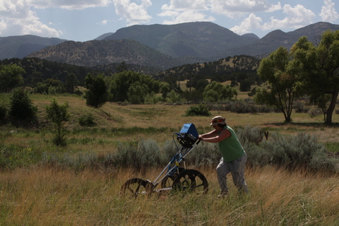
Surveying in New Mexico with the GPR
With funding from several SSHE and NSF grants, the Anthropology, Geospatial and Earth Sciences Department has been able to obtain instrumentation for advanced geophysical and geospatial mapping that can be used by IUP faculty and students for research.
In 2006, the IUP Anthropology and History departments received funding from the State System of Higher Education Technology Fee Special Projects to acquire the first of our advanced geospatial instruments—the Trimble R-8 global positioning satellite mapping system. In 2007, the IUP Anthropology, History, Geography, and Geoscience departments were awarded a National Science Foundation Major Research Instrumentation grant to acquire instrumentation to develop our Mobile Spatial Data Acquisition Technology Lab' (MSDAPT).
Through this funding, we were able to acquire a GSSI Sir System 3000 Ground Penetrating Radar (GPR), a Syscal Pro Electrical Resistivity Meter, a Bartingdon Magnetic Susceptibility system including a survey probe and meter, a Geoscan Research RM 15multiplex unit, a Geoscan Research FM 256 magnetic gradiometer, a set of 6 Trimble Geo XH Global Positioning Systems (GPS), and a Trimble GPS Base Station and support equipment. Later that same year, the Anthropology, History, and Geography departments were again awarded SSHE Tech Fee Special Project Funds to acquire additional instruments.
In 2012, the departments of Anthropology and History acquired an IDS Stream X multiple array ground penetrating radar and Leica ScanStation C10 3-D scanner through a National Science Foundation Major Research Instrumentation grant. The instruments support our collection and processing of highly precise spatial and geophysical data in demanding local and international field settings. They are used both for research and student training.

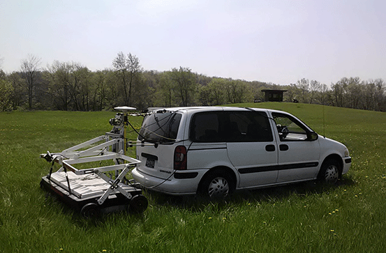
IDS Stream X multiple array ground penetrating radar surveying Aztalan State Park, WI
To date, faculty and students from the Anthropology, Geospatial and Earth Sciences Department have used the MSDAPT in research projects in Pennsylvania, Cyprus, New York, Wisconsin, and New Mexico and have also used the instruments in programs for high school and younger students. Graduate and undergraduate students are able to conduct research in challenging environments. The cultural landscape is a complicated mix of natural and cultural systems in which humans shape and are shaped by the surrounding environment. Understanding this landscape requires the use of specialized technology for mapping, survey, and analysis. The MSDAPT is designed to enhance both research on this complicated landscape and the training of undergraduate and graduate students in the use of state-of-the-art technology.

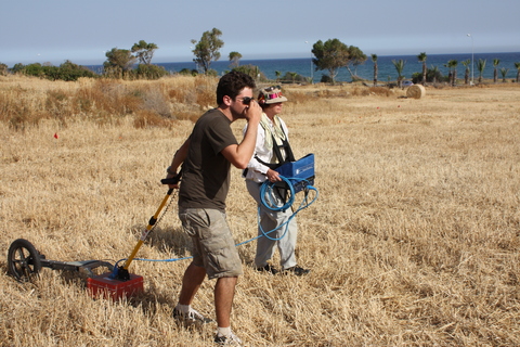
John Crowley and Dr. Chiarulli in Cyprus
This instrumentation supports our research projects by enhancing (1) our ability to identify the spatial and physical distributions of artifacts, ancient sites, and cultural features within the landscape, (2) our discovery of buried cultural features through non-destructive geophysical surveys, and (3) our ability to examine and map interactions among humans and between humans and their built environment, as well as our evaluation of the impact of man-made alterations to the natural environment.
The purpose of the MSADPT instrumentation acquisition is fivefold: 1) it is designed to make the latest and most accurate technology available to faculty in the Anthropology, Archaeology, History, Geography, and Geoscience departments in support of research excellence in the U.S. and abroad; 2) to provide undergraduate students the opportunity in the classroom to learn how to use the latest equipment used by professionals in their fields; 3) to afford undergraduate students the opportunity to gain valuable hands-on field experience using the equipment; 4) to provide graduate students and advanced undergraduate students the opportunity to assist with the design and implementation of field projects; and 5) to foster continued inter-departmental and inter-college communication through collaborative teaching and research.

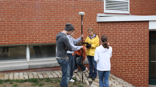
Jason Pare using the Trimble R-8 with students from the Ellis School